Cabo
Verde
Geography |
| |
The Cape Verdean archipelago
consists of 10 larger and 5 smaller islands and
is comprised of a total surface area of app. 4'000
km². The small island world lies between
the 15° and 17° marks of northerly latitude
and the 22° and 25° degree marks of westerly
longitude in the Atlantic, not far from the Tropic
of Cancer. The distance to the African continent
is app. 450 km (west of Senegal) whereas the Canary
Islands are app. 1'700 km north of Cape Verde.
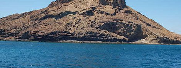
The Cabo Verde Islands originated
from volcanic activity. They were created some
26 million years ago and belong to the mid-Atlantic
back ridge heading in the north/south direction,
from which the Cape Verde barrier branches off
and which also includes the Canaries basin stationed
in the north.
The eastern situated, flat desert islands of Sal,
Boavista and Maio have almost no vegetation. Their
close proximity to the African continent ensures
that – thanks to the Harmattan winds –
fine sand from the Sahara is brought to the islands,
thus providing the islands with kilometres of
beautiful beaches and dunes. |
| |
 |
| |
| The western, mountainous islands
of Santo Antão, Santiago, São Nicolau,
Brava and Fogo have been shaped by intensive volcanism.
High mountains ranging up to 3'000 m and deeply
cut valleys characterize the landscape. The trade
wind clouds coming from the west are then forced
into raining and help create a thick range of
vegetation, at least in the western parts of the
island. |
| |
|
|
 |
|